In high school I used to stay up late at night to watch the weather report. Rain in the Bay Area always meant snow in the Sierras. I would get giddy just thinking about fresh powder and the potential snow pack. I was reminded of that tonight when I read a weather.com storm watch. I don't do as much snowboarding now, but I still get eerily excited when bad (good) weather rolls in.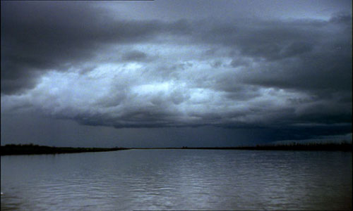 Normally I wouldn't cut and paste things this long, but it's too good to shorten:
"A very active and possibly record producing weather pattern will unfold across the western states over the next few days, as a series of Pacific storms plus plenty of moisture slams ashore. This will bring heavy rain and possible flooding, damaging winds, and deep snow with blizzard conditions to parts of the West through the weekend.
Heavy rain is increasing over western Washington, western Oregon and the northern two-thirds of California. By later Friday into Saturday, heavy rain will also impact southern California and possibly parts of the Desert Southwest. For California, in particular, a widespread 2 to 5 inches of rain will be possible through the weekend, with some southwest facing mountains picking up more than 6 inches of rain.
Flash flooding will be possible, over far western Washington, western Oregon, and a good part of California, especially in burn areas.
Blizzard warnings have been posted by the National Weather Service through early Saturday for the Siskiyou and Sierra Nevada in California. This includes the Shasta Lake and South Lake Tahoe areas.
Snow levels in western Washington will drop from 3000 feet to less than 500 feet by Sunday which could mean snow into Bellingham and Seattle by late in the weekend. Snow levels in the Oregon Cascades will rise to 5000 feet ahead of the Friday storm and then drop steadily through the weekend. Snow levels over northern and central areas of California will rise to between 5000 feet in the Siskiyou and 7000 feet in the central Sierra, falling rapidly to valley floors later Friday and to 1500 feet by late in the weekend. Levels will start around 7000 feet in southern areas, including Yosemite Park, then fall to between 4500 and 5000 feet Saturday and continue to lower Sunday.
Snow is on the increase tonight through Friday night. Snowfall rates of 3 to 6 inches per hour will be possible during the height of the storm.
Snow totals through the weekend are expected to be potentially historic, especially in California with as much as 2 to 6 feet expected, possibly more on the highest peaks. Up to a foot will fall down to valley floors. Several feet of snow will fall in the Cascades and inland across the mountains of Utah, Colorado, northern Arizona and northern New Mexico.
Wind gusts of 75 to 85 mph will be common across the southern Cascades, Sierra and western Nevada into the weekend. Ridge top gusts in the Sierra could peak between 100 and 145 mph.
Winds over 65 mph will also be possible for much of California, including lower elevations and coastal areas, as well as coastal sections of Washington and Oregon and interior parts of the West from Wyoming through Nevada."
Thursday, January 3, 2008
Stormy Weather Turns Me On
Subscribe to:
Post Comments (Atom)

2 comments:
Wow.
Does Ashley give you print-outs of weather.com as a perk when she's especially pleased with ya?
1) I don't want to know what turns you on.
2) Christian and I just saw the weather and it's supposed to dump snow for the next week in Tahoe!!! I think we're going to go up next weekend. We considered driving up there as soon as we get off the plane from Alabama tomorrow. But then we realized that it would be dumping snow and that just wouldn't work. Darn! I'll be just as happy sitting at home and watching it rain. I LOVE stormy weather! Bring on the thunder and lightning and wind!
Post a Comment